
Is the Chisapani–Nagarkot Trek Affected by the 2026 Nepal Floods?
Short answer: no. This short cultural trek runs the forested rim of the Kathmandu Valley through Shivapuri National Park — the Bagmati watershed, well south of the Rasuwa flood. The valley and its trails are open and normal.
📍 Developing story — live updates
The 2026 Nepal floods are a developing emergency and the human toll is still being verified. For the latest confirmed death toll, missing and rescued numbers, and region-by-region trek status, follow our continuously-updated Nepal Floods 2026: Live Updates. The flood itself — where it hit and why — is covered in our Bhote Koshi flash flood report.
The short answer — verified against Nepal media and government advisories and our own team, 26–29 August 2026 (flood figures provisional)
Booking a trek this autumn? We keep a live, region-by-region status page — which trails are open, which access roads are cut, and what we would book right now — updated through the season by our team on the ground: Nepal trekking conditions right now.
- Not affected. The Chisapani–Nagarkot–Dhulikhel trek walks the northern and eastern rim of the Kathmandu Valley through Shivapuri Nagarjun National Park, in the Bagmati watershed. The 26 August flood was in Rasuwa, over the far ridge to the north, in the Bhote Koshi and Trishuli systems. Different rivers, different valley.
- The valley is open and normal. Kathmandu sits at about 1,400 m and was well away from the flood; the UNESCO heritage sites, Thamel and the valley’s roads are all running normally.
- The Sundarijal trailhead is fine. The usual start at Sundarijal (the Shivapuri gate) is open — the Sundarijal–Chisapani section is even being used as an alternative walking approach while some northern roads are cut.
- One honest caveat: the Chisapani end sits toward southern Sindhupalchowk, on the edge of the wider disruption zone. The classic valley-rim route is unaffected, but if you extend north toward Melamchi or Helambu, reconfirm those roads first.
The short version: of all the “is my trek affected” questions we are getting this week, this is the easiest to answer honestly — the Chisapani–Nagarkot walk is the Kathmandu Valley’s own doorstep trek, and the flood never came near it. But because it is a beginner-friendly favourite and people are understandably nervous, let me spell out exactly where it runs, why it is safe, and the one direction where I would still check a road.
Where this trek runs — the valley rim, not the flood zone
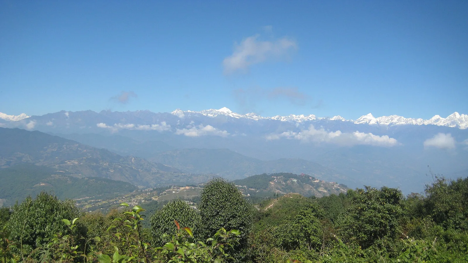
The Chisapani–Nagarkot trek is a short, two-to-four-day cultural walk around the high rim of the Kathmandu Valley. The classic line starts at Sundarijal and climbs into Shivapuri Nagarjun National Park to Chisapani on the northern edge, then traverses the ridge southeast through Nagarkot villages to the famous Nagarkot viewpoint, and often finishes at the Newar town of Dhulikhel or Namobuddha. You are on forested ridgeline between roughly 1,400 and 2,300 m the whole way, looking north to the Himalaya on a clear morning — Langtang, Ganesh Himal, sometimes Everest far to the east.
Crucially, every one of those places drains into the Bagmati and the valley’s own small rivers, which flow south. The 26 August flood came down the Bhote Koshi into Rasuwa and then the Trishuli — north of the valley, on the far side of the Shivapuri ridge, in an entirely separate river system. The high wall of Shivapuri literally stands between this trek and the flooded valleys. That is why Kathmandu itself never flooded and why the rim trek is walking normally.
| Region / segment | Status | What to do |
|---|---|---|
| Sundarijal – Chisapani (Shivapuri NP, northern rim) | Open and normal; used as an alternative walking route by others too | Trek as usual with a park permit; nothing special needed |
| Chisapani – Nagarkot (ridge traverse) | Open and normal | Book as usual for any season — this is a year-round trek |
| Nagarkot – Dhulikhel / Namobuddha | Open and normal; valley roads running | Standard drive out; no disruption reported |
| Northern extensions toward Melamchi / Helambu / Sindhupalchowk | Edge of the wider disruption zone; some roads monsoon-fragile | Reconfirm those specific roads before extending north |
Why this is the safe trek to keep on your plan
If you booked a short Kathmandu-area trek to bookend a bigger trip, this is one I would tell you to keep without hesitation. It is low altitude, it is close to the city, it runs all year including through the monsoon tail, and it sits inside a protected national park with maintained trails. There is no river crossing on the classic route that the flood could have touched, and the drive to Sundarijal and back from Dhulikhel is ordinary valley driving that was never disrupted. In a week where I am telling a lot of people to change their Langtang plans, it is a relief to have a trek I can simply say yes to.
The one honest note — and I would rather give it than leave it out — is the Chisapani side. Chisapani sits on the boundary between the valley rim and southern Sindhupalchowk, which is on the outer edge of the districts that saw monsoon damage. The rim-walking route itself is fine. But if your itinerary pushes north from there toward Melamchi or into the Helambu region, those approach roads are more monsoon-fragile and worth a direct check before you commit. On the standard Sundarijal–Chisapani–Nagarkot–Dhulikhel loop, you never go that way.
Our honest steer: keep this trek. It is one of the cleanest “yes” answers on the board right now — low, close, protected and running normally — and it makes an ideal acclimatisation warm-up or a standalone valley trip while the bigger northern routes recover. For the full national picture, see our live conditions page, and for what actually happened up north, our flood report.
How we run it right now — and an honest word on booking
Let me be straight about the product, because I would rather you trust the next thing I say. We do not currently list the full multi-day Chisapani–Nagarkot–Dhulikhel trek as a one-click booking on the site — the closest published trip is our Nagarkot Sunrise & Himalayan View day tour, which catches the same dawn panorama in a single day from Kathmandu. The two-to-four-day rim trek is something we arrange to order, with a licensed guide, park permits and teahouse or resort nights along the ridge. If that is what you want, message us and we will build it for your dates rather than point you at a page that does not exist.
Either way, we run it with a guide who knows the Shivapuri trails and current conditions, and we will tell you honestly if any extension you are considering strays toward the disrupted north. For the dawn view on a tight schedule, the day tour is genuinely the better-value pick and we will say so.
Want the Kathmandu Valley rim trek or the sunrise view?
We’ll build the 2–4 day Chisapani–Nagarkot–Dhulikhel trek to your dates, or set you up with the one-day Nagarkot sunrise tour — and tell you honestly which fits your trip.
If you want to help. Nepal’s official relief channel is the government’s Prime Minister’s Disaster Relief Fund — restricted by law to rescue, relief and rehabilitation, audited annually, and it takes international cards directly. We collect nothing and receive nothing. Be careful of account numbers circulating in forwarded messages: disaster fundraising draws scams within days. Our full guide is at where to donate for the Nepal floods.
Cover photo: Bandana kc via Wikimedia Commons (CC BY-SA 3.0).
计划徒步?
我们负责许可证、后勤与向导
NMA 认证的本地向导,价格透明,自 1998 年以来 5,000+ 次徒步。告诉我们你的日期,其余的交给我们。

更多「Safety & Advisories」

Safety & Advisories
Is the Lobuche Peak Climb Affected by the 2026 Nepal Floods?
Short answer: no. Lobuche Peak (6,119 m) is an NMA climbing peak in the Everest region, reached via Lukla on the Dudh Koshi — a separate watershed from the Rasuwa flood. The route is unaffected; the only real variable is monsoon-season Lukla flights.
Safety & Advisories
Is the Annapurna Circuit Trek Affected by the 2026 Nepal Floods?
Short answer: the Circuit trail itself was not hit — it runs the Marsyangdi and Kali Gandaki on the far western side of the country, a different river system from the Rasuwa flood. The one real catch is the drive in: confirm the Prithvi Highway to Besisahar, or fly to Pokhara.
Safety & Advisories
Is the Helambu Trek Affected by the 2026 Nepal Floods?
Mostly no, but this one needs a real check. The Helambu trails were not hit by the Rasuwa flood, but Helambu sits on the edge of the disruption zone on a monsoon-fragile access road. Reconfirm road access before you commit — and right now the no-doubt choice is Poon Hill or Annapurna.