
Nepal Has the World's Steepest Zip Line — and You Launch Off a Ridge Above Pokhara at 140km/h
A certified 56-degree drop over the Seti Gandaki valley makes Pokhara's ZipFlyer the steepest zip line on Earth — here is what a 1.8-kilometre, near-vertical descent from Sarangkot actually involves.
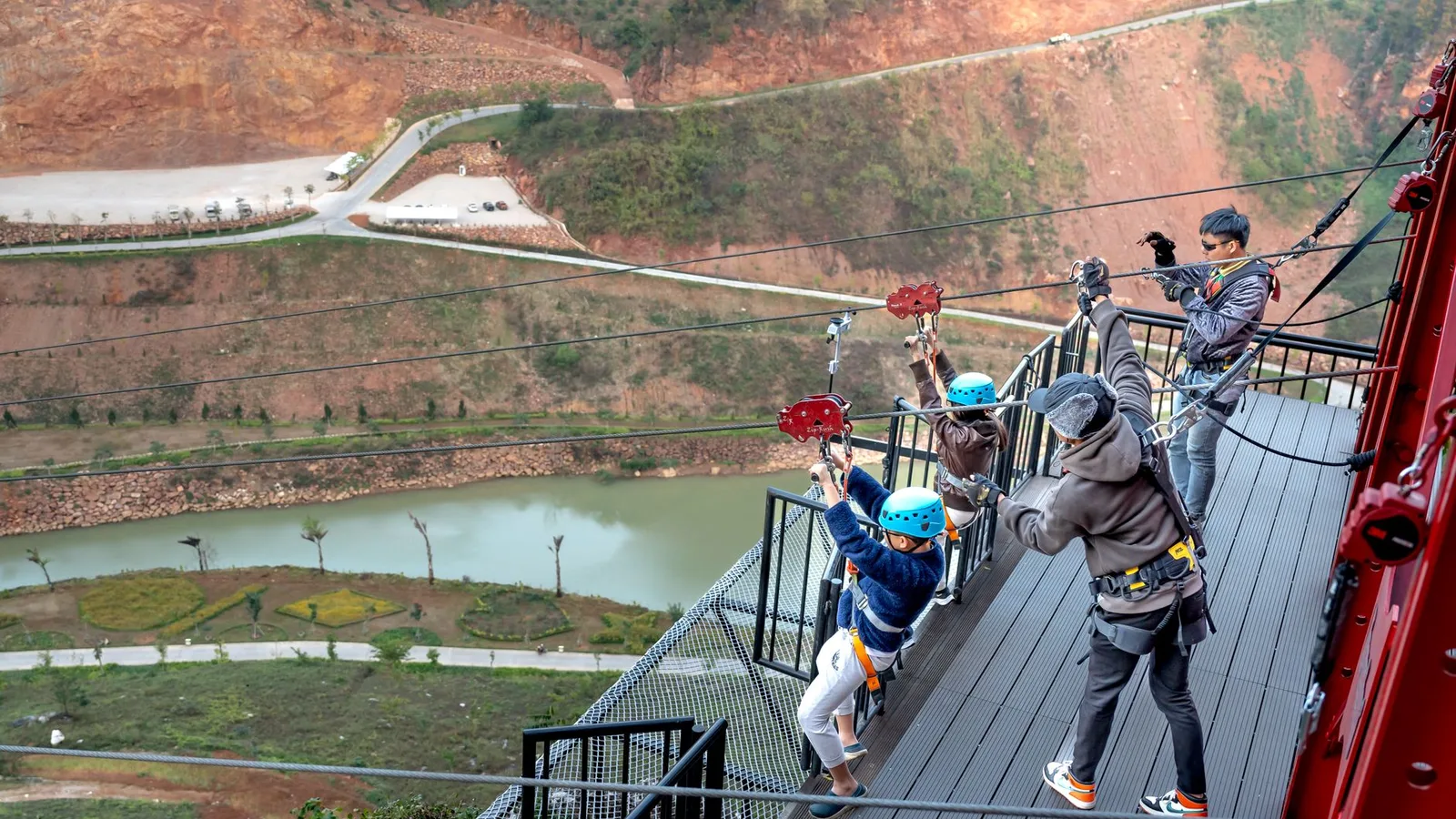
Most zip lines let gravity do a gentle favour. This one does not. Step off the platform above Sarangkot and for the first stretch of the ride you are dropping at 56 degrees from horizontal — steeper than a black-diamond ski run, steeper than any other zip line operating anywhere in the world, according to the international adventure-record body Official World Record (OWR).
Key facts
- Certified the world's steepest zip line by degree of incline: 56°
- Total cable length: 1,850 metres (1.8km), with a vertical drop of over 600 metres
- Top speed on the line: reported at 100–140+ km/h
- Runs from Sarangkot ridge (1,550m) down to Hemja village (950m), on the edge of Pokhara
The line is operated by HighGround Adventures Nepal, whose own listing calls it 'the steepest and one of the longest ziplines in the World' — a claim that has also been picked up by Red Bull's global adventure-travel coverage. Nepali outlets including Republica have separately reported the 'tallest' and 'steepest' titles being awarded to the same installation. Riders clip in at a launch deck cut into the Sarangkot ridgeline — the same hillside thousands of visitors climb before dawn for Pokhara's famous Annapurna sunrise view — and are released into open air over the Seti Gandaki valley below.
What makes the number credible rather than just marketing copy is the geography doing the work. Pokhara sits at the point where the Annapurna massif drops almost directly into the Pokhara Valley floor — one of the steepest elevation changes over the shortest horizontal distance anywhere in the Himalayan foothills. A cable strung across that terrain is, almost by definition, going to be steeper than one built across a gentler valley in the Alps or Rockies, where most of the world's long zip lines are engineered. The same topography is why Pokhara is also one of the world's most popular paragliding launch sites — the mountains simply fall away faster here than almost anywhere else on the planet.
| Station | Altitude | Role |
|---|---|---|
| Sarangkot (launch) | 1,550m | Ridge-top platform, also Pokhara's main sunrise viewpoint |
| Hemja (landing) | 950m | Valley-floor village on Pokhara's western edge |
| Net drop | 600m | Roughly the height of the Sears Tower stacked on itself |
What this means for travellers
What this means for you
You do not need a trekking permit, altitude acclimatisation or expedition-level fitness to feel Nepal's vertical drop — the ZipFlyer compresses it into about two minutes, harnessed and guided, for the cost of a nice dinner. It sits at the same trailhead as some of the Annapurna region's easiest hikes, so it slots naturally either side of a short walk or a paragliding flight rather than requiring its own day.
Our guides route first-time visitors to Pokhara through exactly this kind of half-day adrenaline stack: an early hike up to Sarangkot or nearby Nagdanda for the sunrise over Machhapuchhre and the Annapurnas, then the option of paragliding down, or riding the record-breaking line down to Hemja instead. Both start from the same ridge that gives Pokhara its view — and both exist only because of the same abrupt, record-worthy drop from mountain to valley that defines this part of Nepal. It is worth noting the ride is a standalone activity add-on, not a trek in itself; book it as a side trip around your main Annapurna itinerary rather than a substitute for one.
Source: HighGround Adventures Nepal (operator specifications); Republica/Nagarik Network, reporting the Official World Record steepest/tallest zip line titles.
Cover photo: Quang Nguyen Vinh via Pexels (Pexels License).
来源: HighGround Adventures Nepal
计划徒步?
我们负责许可证、后勤与向导
NMA 认证的本地向导,价格透明,自 1998 年以来 5,000+ 次徒步。告诉我们你的日期,其余的交给我们。


更多「Records & People」
Records & People
Mount Everest's Summit Is Made of Ancient Seafloor — and the Fossils Are Still There
The highest rock on Earth is 450-million-year-old limestone packed with fossilised sea creatures — proof the roof of the world was once the floor of a tropical ocean.
Records & People
There's a Flame in Nepal That Has Burned on Water for Centuries — and Hindus, Buddhists and Sikhs All Call It Holy
At 3,710 metres in Mustang, a natural-gas flame burns beside a glacial spring that has never run dry — one of the only shrines in the Himalaya shared, uncontested, by two major faiths for centuries.
Records & People
The World's Third-Highest Mountain Has, Technically, Never Been Summited
For nearly 70 years, every climber who has reached Kanchenjunga has stopped a few feet short of the true top — a promise kept out of respect for a sacred mountain.