
From Rice Paddies to Arctic Desert in 12 Days: The Wild Climate Range Inside Nepal's Annapurna Circuit
One trek, one conservation area, four climate zones and 1,226 species of wildflowers — the numbers behind Nepal's most complete walk through the Himalaya.
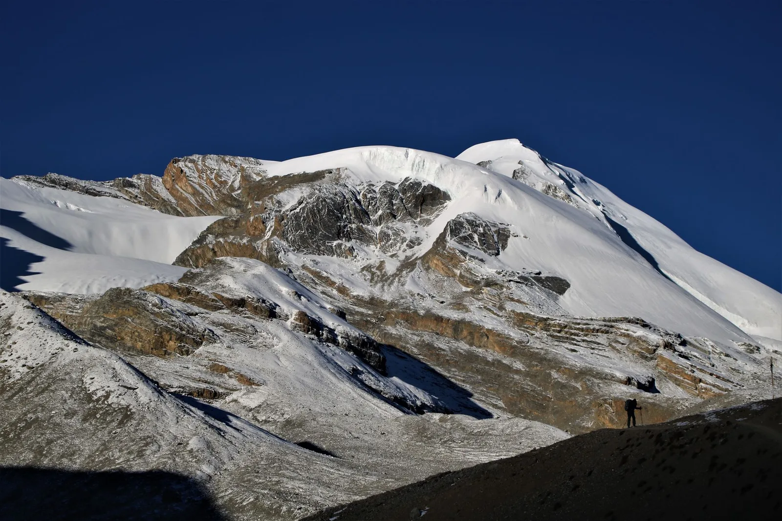
Start at the trailhead near Besisahar and you're walking through rice terraces and sal forest at under 800m, thick with monsoon humidity. Twelve days and roughly 90km later, you're crossing a 5,416m pass into a wind-scoured desert that looks more like Tibet than Nepal. No other single trek in the Annapurna region packs in this much ecological range — and the numbers behind it are official, not marketing.
Key facts
- The Annapurna Conservation Area covers 7,629 sq km — Nepal's largest protected area, established in 1986.
- It holds 1,226 species of flowering plants, 105 mammals and 523 birds, more than almost any comparably sized stretch of the Himalaya.
- The classic circuit climbs from roughly 760m river valleys to the 5,416m Thorong La pass, the trek's highest point.
- Cross that pass and the land flips from green monsoon-fed forest to arid, treeless high desert in a single day's walk.
The reason is geography, not luck. The Annapurna massif — eight peaks over 7,000m, including 8,091m Annapurna I — sits directly in the path of the summer monsoon rolling up from the Bay of Bengal. The southern flank catches nearly all of that moisture, feeding the sal forests, waterfalls and terraced farmland lower down the trail. The northern side, in the rain shadow, gets almost none of it. Manang and Mustang, on the far side of Thorong La, sit in a climate closer to the Tibetan plateau than to tropical Nepal, a few dozen kilometres and one pass away.
| Zone | Elevation | What you'll see |
|---|---|---|
| Subtropical | below ~1,000m | Rice terraces, sal forest, waterfalls |
| Temperate | 1,000–3,000m | Oak, rhododendron and pine — the richest biodiversity band |
| Subalpine / alpine | 3,000–5,000m | Juniper scrub, alpine meadow, yak pasture |
| Trans-Himalayan desert | Manang & Mustang, rain shadow | Arid high desert, Tibetan-plateau ecology |
What actually lives here
The conservation area protecting this corridor — run by Nepal's National Trust for Nature Conservation — isn't a token designation. It's the largest protected area in the country, and the species count reflects the range of terrain it covers: snow leopards and Himalayan tahr in the high alpine zone, red pandas and musk deer in the temperate forest belt, and over 500 recorded bird species from Himalayan monal pheasants to steppe eagles drifting over the Mustang desert. Few conservation areas anywhere ask a single ranger corps to manage subtropical jungle and high-altitude desert inside the same boundary.
What this means for trekkers
What this means for trekkers
Pack for two completely different climates on one trip. Below Manang, expect humid, leech-prone lower trails in monsoon shoulder months and warm days year-round; above Thorong La, expect desert-dry air, brutal UV and nights well below freezing even in the trekking high seasons of spring and autumn. Most operators build in acclimatisation days around Manang (3,540m) specifically because the jump from forest to desert is also a rapid jump in altitude — the ecological drama and the altitude risk come from the same geography.
It's also, still, one of the world's great classic treks precisely because it hasn't been simplified into a single-biome walk. Nepal's largest rhododendron forest, a short detour to the south, blooms in the same conservation area every spring, and the ACAP permit that covers this trek is one fee for all of it, jungle to desert. For a first-time visitor deciding which corner of the Himalaya actually shows them the most, the case for Annapurna over a single-ecosystem trek elsewhere is mostly the elevation profile itself.
Source: National Trust for Nature Conservation (NTNC)
Cover photo: Vertex Holiday via Pexels (Pexels License).
来源: National Trust for Nature Conservation (NTNC)
计划徒步?
我们负责许可证、后勤与向导
NMA 认证的本地向导,价格透明,自 1998 年以来 5,000+ 次徒步。告诉我们你的日期,其余的交给我们。


更多「Trail & Weather」
Trail & Weather
How cold does the Everest Base Camp trek actually get? Real night temperatures by altitude and month
The honest numbers: about −10°C to −15°C on a normal autumn or spring night at the highest camp, and below −20°C in mid-winter — plus exactly what to pack for it.
Trail & Weather
Annapurna Circuit vs Annapurna Base Camp: They Share a Name, Not a Trek — The Honest 2026 Difference
One crosses a 5,416-metre pass into the desert beyond the Himalaya; the other walks into a glacial amphitheatre at 4,130 metres. Here's which one actually matches what you're picturing when you say Annapurna.
Trail & Weather
Nepal's Monsoon Is Still Cutting Roads to Annapurna, Manaslu and Langtang — Here's When Each Trail Clears for Autumn 2026
This week floods severed the access roads to Manang and Rasuwa, and landslides remain a fixture on the Manaslu trailhead road. We checked conditions region by region and worked out when trekkers can actually expect firm, dry trails this autumn.