
The World's Deepest Gorge Splits Two 8,000-Metre Peaks — and a Trail Runs Right Through It
Nepal's Kali Gandaki Gorge drops 5,571 metres between Annapurna and Dhaulagiri, deeper than the Grand Canyon three times over — and the Annapurna Circuit walks straight along its floor.
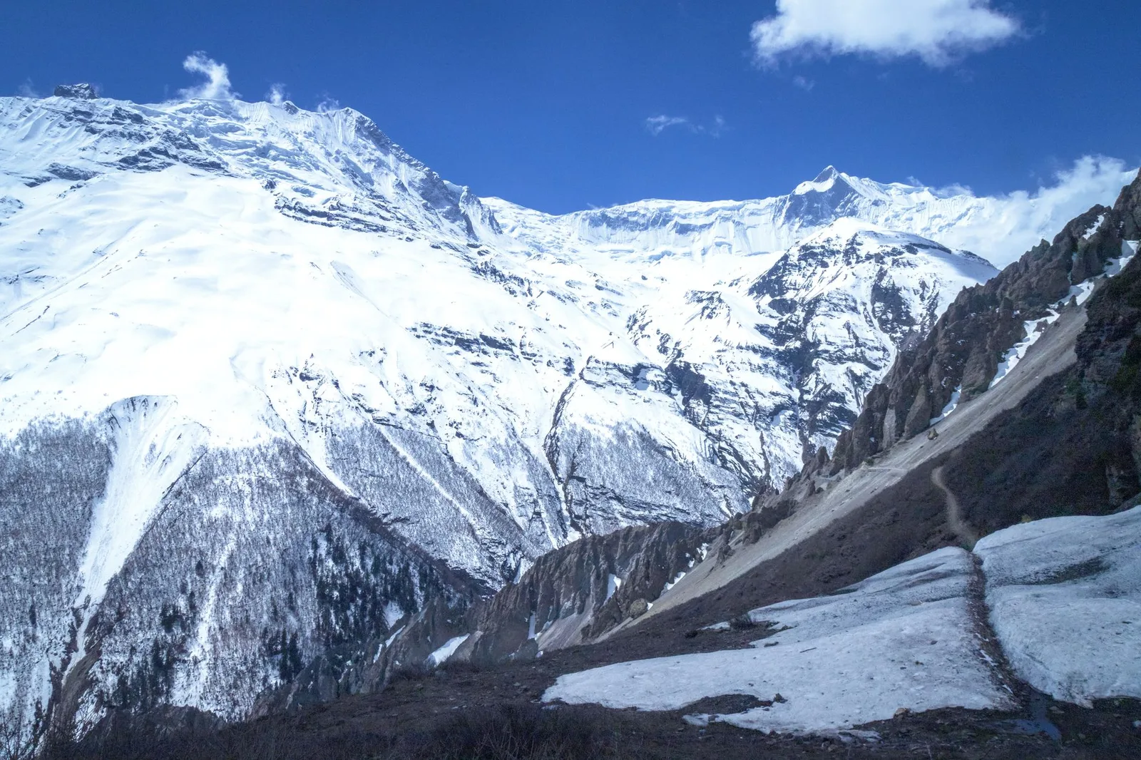
Stand on the summit of Annapurna I and look straight down, and the ground falls away for 5,571 metres before it reaches a river. That single number — the vertical drop from an 8,000-metre peak to the valley floor beside it — makes Nepal's Kali Gandaki Gorge the deepest gorge on Earth, more than three times the depth of the USA's Grand Canyon. And unlike most of the world's great chasms, you don't need a helicopter or a rope to see the bottom of this one. A trekking trail runs straight along its floor, walked by pilgrims and salt traders for over a thousand years before it became one of Nepal's most popular routes.
Key facts
- Vertical drop from Annapurna I's summit to the riverbed: 5,571 metres (18,278 ft)
- The gorge separates two 8,000-metre giants: Dhaulagiri (8,167m) to the west and Annapurna I (8,091m) to the east
- The riverbed itself sits at just 2,520 metres above sea level
- It's walked as part of the Annapurna Circuit, inside the Annapurna Conservation Area
How a river cuts faster than mountains rise
The Kali Gandaki is older than the Himalaya themselves. Geologists believe the river's course predates the tectonic collision between the Indian and Eurasian plates that has pushed Dhaulagiri and Annapurna skyward over the last several million years. As the land buckled and rose beneath it, the river held its ancient path and simply cut down as fast as the mountains went up, carving a structural trench, a graben in geological terms, between the two peaks rather than being displaced by them. The result is a canyon where the walls are still actively rising even as the river keeps sawing through the middle of it. Canyons like Peru's Colca and Cotahuasi are sometimes mentioned in the same breath, but neither separates two 8,000-metre summits the way the Kali Gandaki does.
| Point | Elevation |
|---|---|
| Dhaulagiri I summit (west wall) | 8,167 m |
| Annapurna I summit (east wall) | 8,091 m |
| Kali Gandaki riverbed (gorge floor) | 2,520 m |
| Vertical relief, Annapurna I to riverbed | 5,571 m |
The fossils in the riverbed
Walk the gorge floor near Kagbeni or Jomsom and it's common to see trekkers and pilgrims crouched over the loose grey stones of the riverbed, cracking them open. Inside are ammonites, coiled, chambered shells that are the remnants of the Tethys Ocean which once covered this entire region before the Indian subcontinent drifted north and collided with Asia. In Hinduism these fossils are called shaligrams and are revered as a living form of Vishnu; many are carried home as sacred objects rather than souvenirs. It's a strange thing to register while standing at 2,500 metres in the middle of the Himalaya: the rock under your boots was once a seabed, and the ocean's shells are still washing out of the walls of the two highest mountains on the planet.
What this means for trekkers
What this means for you
The gorge isn't a detour from the trail, it is the trail. The classic Annapurna Circuit and the shorter Jomsom–Muktinath trek both follow the Kali Gandaki upstream through Tatopani, Ghasa, Marpha and Jomsom before climbing out toward Muktinath, meaning you walk the floor of the world's deepest gorge for two to three days without technical climbing, specialist gear, or anything beyond a standard ACAP permit. The trade-off is wind: by early afternoon the gorge acts as a funnel and gusts regularly pick up through Kagbeni and Jomsom, which is why guides plan the day's walking before midday. Trekkers heading further north toward the Tilicho Lake side valley feel the same effect even more sharply.
For anyone weighing where to spend a bucket-list trip, it's worth knowing this canyon exists at all. The Grand Canyon gets the postcards, but the deepest gorge on Earth is a walking trail in Nepal, and most people who take it don't fully register what they're standing inside of until they look straight up.
Source: Wikipedia — Kali Gandaki Gorge
Cover photo: Ashok J Kshetri via Pexels (Pexels License).
来源: Wikipedia
计划徒步?
我们负责许可证、后勤与向导
NMA 认证的本地向导,价格透明,自 1998 年以来 5,000+ 次徒步。告诉我们你的日期,其余的交给我们。


更多「Records & People」
Records & People
The Temple Where Fire Burns on Water — and Two Religions Call It Holy
At 3,762 metres in Nepal's Mustang district, natural gas burns continuously above a spring inside Jwala Mai temple, part of a shrine both Hindus and Buddhists climb the Himalaya to reach.
Records & People
Nepal Just Named a 2-Year-Old a Living Goddess — She Can't Touch the Ground Until She Retires
Aryatara Shakya was enthroned as Kathmandu's Royal Kumari in 2025, the latest in a 17th-century tradition of worshipping a toddler as a living deity.
Records & People
He's Climbed Everest 32 Times — More Than Anyone Alive, and No One Else Is Within Two
Kami Rita Sherpa set the record again on 17 May 2026, extending a world record he has now owned for eight straight years.