
Glacial Lake Outburst Floods: Nepal’s Fast-Growing Mountain Hazard in 2026
As Himalayan glaciers retreat they leave meltwater lakes dammed by loose moraine — and when a dam fails, the flood tears down the valley. Here is what a GLOF is, why they are increasing, and what Nepal is doing about it.
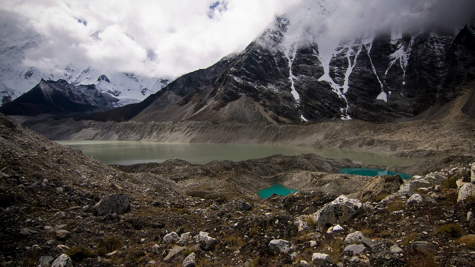
On a clear night in August 2024, a small lake high above the Sherpa village of Thame, in the Everest region, gave way. A wall of water, mud and boulders swept down the valley, damaging homes and buildings in one of the most iconic trekking corridors on Earth. The flood was a plain warning of a hazard that is growing across the Nepal Himalaya as the glaciers retreat: the glacial lake outburst flood, or GLOF.
Key facts
- A GLOF is the sudden, catastrophic release of water from a lake dammed by glacier ice or a loose terminal moraine — a natural dam that can fail in minutes
- They are becoming more frequent because retreating glaciers both feed existing lakes and leave new meltwater lakes behind, and the Himalaya is tectonically active
- A widely cited 2001 study identified 20 potentially dangerous glacial lakes in Nepal, up from five flagged in 1996
- Mitigation works: Imja Tsho in the Everest region was partly drained in 2016, and Tsho Rolpa in Rolwaling has an outlet channel and an early-warning system
What actually happens when a glacial lake bursts
As a glacier flows downhill it bulldozes rock and rubble ahead of and beside it. When the ice retreats, that debris is left as a horseshoe of loose sediment — a moraine — and meltwater ponds behind it. Over years, that pond can grow into a lake holding millions of cubic metres of water, held back by nothing more solid than a bank of frozen rubble.
The dam can fail in several ways. Water pressure slowly erodes a channel through it; an avalanche of rock, ice or heavy snow crashes into the lake and sends a wave over the rim; an earthquake shakes the barrier loose; or a chunk of the parent glacier calves into the water. Once a breach starts, it feeds itself: the escaping water cuts the channel deeper, and the whole lake can empty in hours. Peak discharges can reach roughly 15,000 cubic metres per second, and the surge can run up to 50 metres deep down a stream that is normally a shallow trickle. Everything in the valley floor — trails, bridges, teahouses, farmland and hydropower intakes — is in its path.
Why they are becoming more frequent
The engine behind the trend is glacier melt. As the Himalaya warms, two things happen at once. Existing glacial lakes receive more meltwater and grow larger and deeper, raising the pressure on their moraine dams. And as glacier tongues shrink back, they expose fresh basins where entirely new lakes form. More lakes, holding more water, behind dams that were never built to last, mean more chances for a catastrophic failure — and the risk is especially acute in the Himalaya, where the geology is young and earthquake-prone.
This is the same story we have covered from the ice up: our report on how the Khumbu Glacier could lose most of its ice by 2100 describes the retreat that creates these lakes, and the melt is reshaping the high mountain in other unsettling ways too.
Nepal’s dangerous lakes
Not every glacial lake is a threat. The danger depends on the lake’s size, how fast it is growing, the state of its moraine dam and what lies downstream. Scientists rank the worst offenders as “potentially dangerous” glacial lakes, and several sit directly above valleys that trekkers walk every season. The most-watched include Imja Tsho and Tsho Rolpa, along with names such as Dig Tsho, Thulagi and Lower Barun. The 2024 Thame flood — the subject of its own investigation and the myths that grew around it — came from a lesser-known lake, a reminder that the hazard is not confined to the famous ones.
| Lake | Region / basin | Risk & action |
|---|---|---|
| Imja Tsho | Everest / Dudh Koshi | One of the fastest-growing lakes in the Himalaya; outlet built and >4 million m³ drained in 2016 |
| Tsho Rolpa | Rolwaling / Tamakoshi | Outlet works plus an early-warning system; threatens some 6,100 people downstream |
| Dig Tsho | Khumbu / Bhote Koshi | Site of a documented Himalayan outburst flood |
| Thulagi | Manaslu / Marsyangdi | Long listed among Nepal’s potentially dangerous lakes |
| Lower Barun | Makalu / Arun | Flagged for monitoring among the country’s high-risk lakes |
What Nepal is doing about it
The good news is that GLOFs are one of the few climate hazards you can actually engineer against. The flagship example is Imja Tsho, the fast-growing lake at 5,000 metres below Island Peak in the Everest region. In 2016 the UN Development Programme, the Nepal Army and the government’s hydrology department cut a controlled outlet and drained more than four million cubic metres of water, lowering the lake to take pressure off its moraine dam — a physically brutal job carried out at an altitude where every sandbag has to be carried or flown in.
The pioneer was Tsho Rolpa in the Rolwaling valley, one of the largest and most studied glacial lakes in Nepal. Engineers cut an outlet to lower the lake and installed an early-warning siren system for the villages strung along the Tamakoshi below — a system that has since had to be maintained and modernised, a reminder that these defences need ongoing money and attention, not a one-off fix. Alongside the physical works, satellite monitoring now keeps a continuous eye on how the highest-risk lakes are changing from one season to the next.
What this means on the trail
Some of Nepal’s classic routes — the Everest, Rolwaling, Manaslu and Langtang trails among them — run through valleys shaped by past floods, and a few pass close to the lakes themselves. This is not a reason to stay home; the odds on any given day are very low. But it is a reason to trek with people who know the ground. A good local guide knows where the valley narrows, which stretches to clear quickly in heavy weather, and where the high ground is if a river suddenly turns brown and loud. That local knowledge is the real early-warning system.
See it for yourself
You do not have to choose between witnessing the changing Himalaya and being sensible about it. The Everest Base Camp via Gokyo Lakes trek traverses the giant Ngozumpa glacier and its string of turquoise melt-lakes — the very process this story is about, seen up close. The classic 14-day Everest Base Camp Trek walks the Khumbu valley below Imja, and the gentler Langtang Valley trek follows a river corridor that has learned hard lessons about mountain hazards. Every departure runs with experienced Nepali guides who read these valleys for a living — talk to our team about the right season and route for you.
Cover photo: Daniel Alton Byers via Wikimedia Commons (CC BY-SA 3.0).
This story is part of Travel Himalaya Nepal’s in-depth look at how climate change is reshaping the Himalaya.
来源: ICIMOD
计划徒步?
我们负责许可证、后勤与向导
NMA 认证的本地向导,价格透明,自 1998 年以来 5,000+ 次徒步。告诉我们你的日期,其余的交给我们。


更多「Climate & Environment」
Climate & Environment
Nepal's Glaciers Are Retreating up to 28 Metres a Year — the Science, and What It Means for the Rivers Below (2026)
The ice below Everest is measurably shrinking — a decades-long record of retreat that pours extra water into Nepal's rivers now, but threatens the supply that keeps them flowing later.
Climate & Environment
Everest's Melting Ice Is Uncovering Decades of Waste and Lost Climbers — and Nepal's Army Is Bringing Them Down (2026)
Warming has thinned Everest’s ice, exposing old waste and long-lost climbers — and driving Nepal’s army-led clean-up campaigns.
Climate & Environment
From Rice Paddies to Arctic Desert in 12 Days: The Wild Climate Range Inside Nepal's Annapurna Circuit
One trek, one conservation area, four climate zones and 1,226 species of wildflowers — the numbers behind Nepal's most complete walk through the Himalaya.