
What the Bhote Koshi flood actually did to Rasuwa and Nuwakot, in seven photographs
Drone and ground pictures from Devighat, Trishuli and the Rasuwagadhi tunnels show a valley filled to the second storey with grey silt rather than washed away.
At a glance
- Published
- TopicSafety & Advisories
- Verified againstThe Kathmandu Post; EU Emergency Response Coordination Centre
- Treks coveredAnnapurna Base Camp Trek — 11 Days from Pokhara, Everest Base Camp Trek — 14 Days
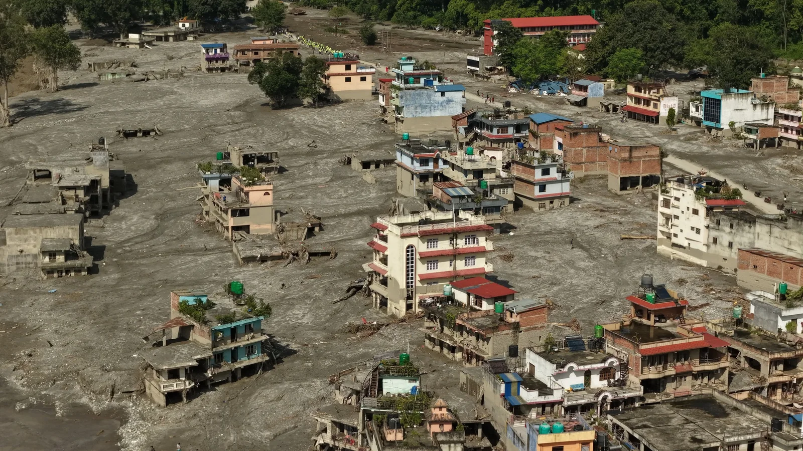
The Bhote Koshi flood did not wash these towns away. It filled them — the aerial pictures from Devighat and Trishuli show four- and five-storey buildings still standing with grey silt packed to the second floor and the entire riverbank flattened into a plain of mud. That distinction matters, because it is why the missing figure has stayed so much larger than the confirmed dead: much of what the flood took, it buried in place.
Key facts
- Debris travelled roughly 80 km down the Bhote Koshi and Trishuli at around 50 m/s
- 41 bridges damaged and about 42 km of road destroyed
- 431 MW of generation knocked off the national grid; six major hydropower and transmission sites hit
- Provisional national toll on 31 August: 903 dead, 4,247 missing, 10,451 rescued
We guide the Langtang and Rasuwa side of this catchment and have done since 1998. These are not our photographs — they were taken by Nepali journalists and residents in the days after and shared publicly. We have credited each one and linked the original post. What we can add is the reading: what you are actually looking at in each frame, and why it matters to anyone who walks these valleys.
Devighat, from the air
Look at the tree line on the left of that frame and then at the roofs. The pale surface between them is not water; it is deposited sediment, metres deep, and it set hard within days. Excavators, not boats, are what this stage of the disaster needs, and the one road that could bring them was itself cut in 42 places.
The house that did not move
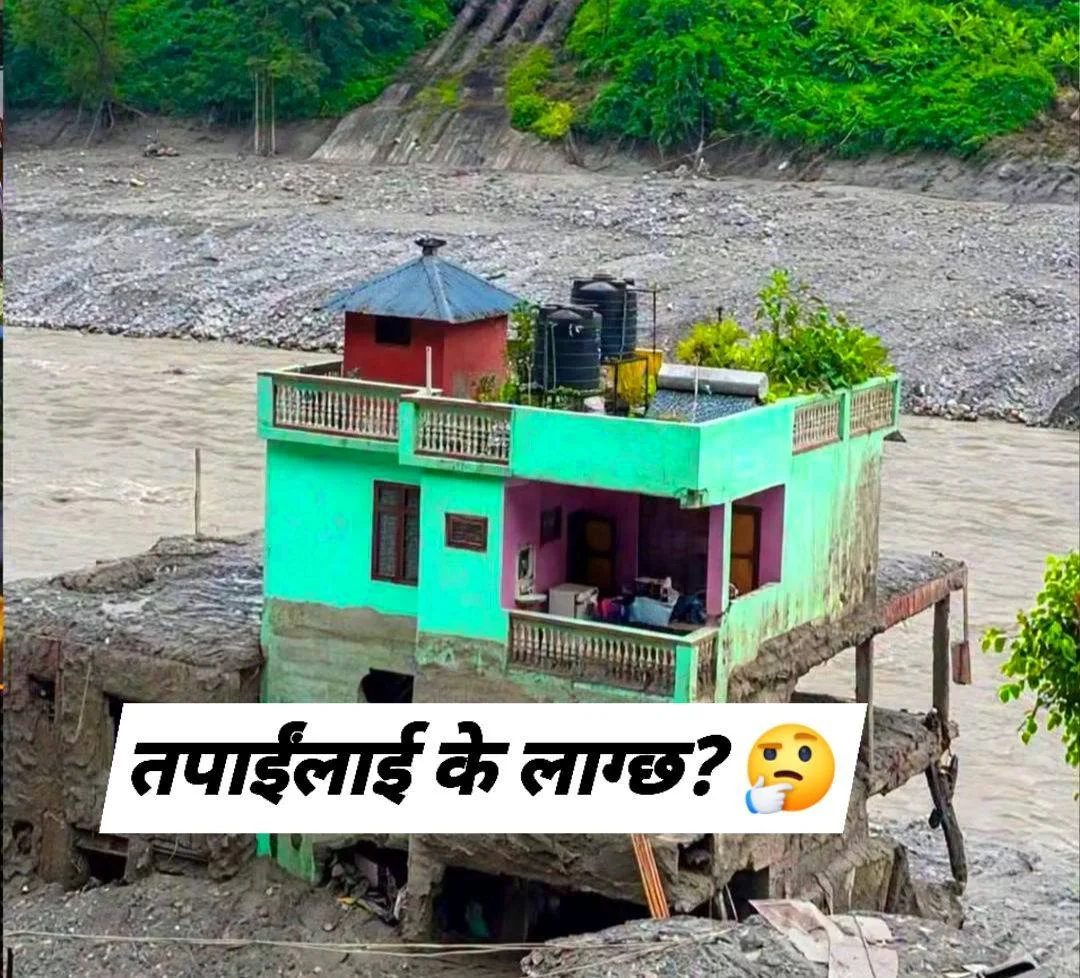
Pictures like this get shared as miracles. The duller explanation is usually geometry — a spur of bedrock, a bend that split the flow, a neighbour’s wall that took the first hit. It is worth saying plainly because the same geometry is what decides which teahouse on which bank survives the next one, and that is a thing you can actually look for on a trail.
Inside the Rasuwagadhi tunnels
The search underground · Rasuwagadhi
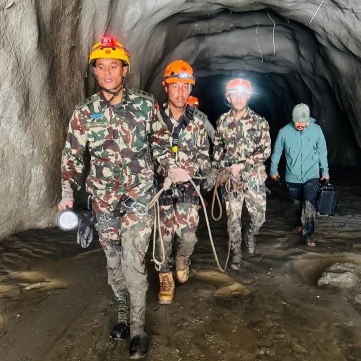
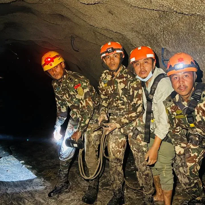
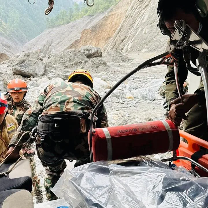
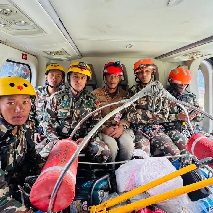
Tunnel search photographs: Chinari Post, via Instagram, 31 August 2026.
These four frames are the hardest part of the story and the least seen. The search team went into the Rasuwagadhi headrace, found no one, and walked back out to Dhunche. Nepal’s independent power producers count 934 people unaccounted for across 11 projects; the army prioritised 19 tunnels. At Chilime, executive director Baburaj Maharjan put it flatly: “We have not been able to carry out a rescue. The tunnel is filled with mud, and it is impossible to enter.”
| District | Dead |
|---|---|
| Chitwan | 272 |
| Nawalparasi (East) | 207 |
| Nawalparasi (West) | 151 |
| Nuwakot | 95 |
| Gorkha | 62 |
| Dhading | 55 |
| Tanahun | 37 |
| Rasuwa | 24 |
These are the official recoveries, and they carry the same surprise: Rasuwa, where the flood began, is not where most people died. Chitwan, roughly 150 km downstream on the Narayani, has recovered by far the most — 272 against Rasuwa’s 24 — because that is where the water spread out across settled flat ground, and because the river carried the dead down to it.
What this means for trekkers
What this means for you
Rasuwa and Langtang are closed to trekking in any meaningful sense and our departures there are paused, not discounted. Everest, Annapurna, Manaslu and the Khumbu are in separate river systems and are running normally — do not read these photographs as a picture of Nepal. If you want to help, cash to the Prime Minister’s Disaster Relief Fund beats shipped goods, which occupy road space that excavators need.
Why do the buildings look undamaged?
Because a debris flow is not a wave that knocks things over so much as a moving mass of sediment that fills whatever it reaches. Reinforced concrete frames survived; everything at ground level did not. It is also why demolition and excavation, not drying out, is what recovery looks like here.
Are these photographs verified?
They were published by Nepali news accounts and residents between 29 and 31 August and match the locations they name. We have linked each original so you can check it. Where a figure appears in this piece it comes from the Kathmandu Post, the EU’s ERCC daily map or Nepal’s disaster authority, not from a caption.
Is the Langtang trek finished for autumn 2026?
For the near term, yes, and we would rather say that than sell you a departure we cannot run. Our running assessment sits in is Langtang open after the flood, and the wider status page is here.
Updated 31 August 2026 with the National Disaster Risk Reduction and Management Authority’s revised figures: 903 confirmed dead, 4,247 missing and 10,451 rescued, up from 788 dead the previous day.
Still running this season
Everest Base Camp Trek — 14 Days is running normally
NMA-certified local guides, transparent pricing, 5,000+ treks since 1998. Message us your dates and we'll sort the permits, lodges and logistics — reply within 24 hours, no obligation.

Popular Nepal treks
All treks →


Related coverage
Breaking Safety & Advisories
Nepal Floods 2026: Live Updates, Death Toll and Trek Status (Rasuwa / Bhote Koshi + Nationwide)
Live tracker of Nepal’s August 2026 floods — the provisional, rising death toll across eight districts, the disputed cause of the Bhote Koshi glacial flood in Rasuwa, and what it means for trekkers right now.
Safety & Advisories
The Bhote Koshi flood took Timure in about seven minutes, here's how four people got out
Four named survivors describe running uphill as the market disappeared behind them, and a CCTV timestamp shows how little warning anyone downstream actually had.
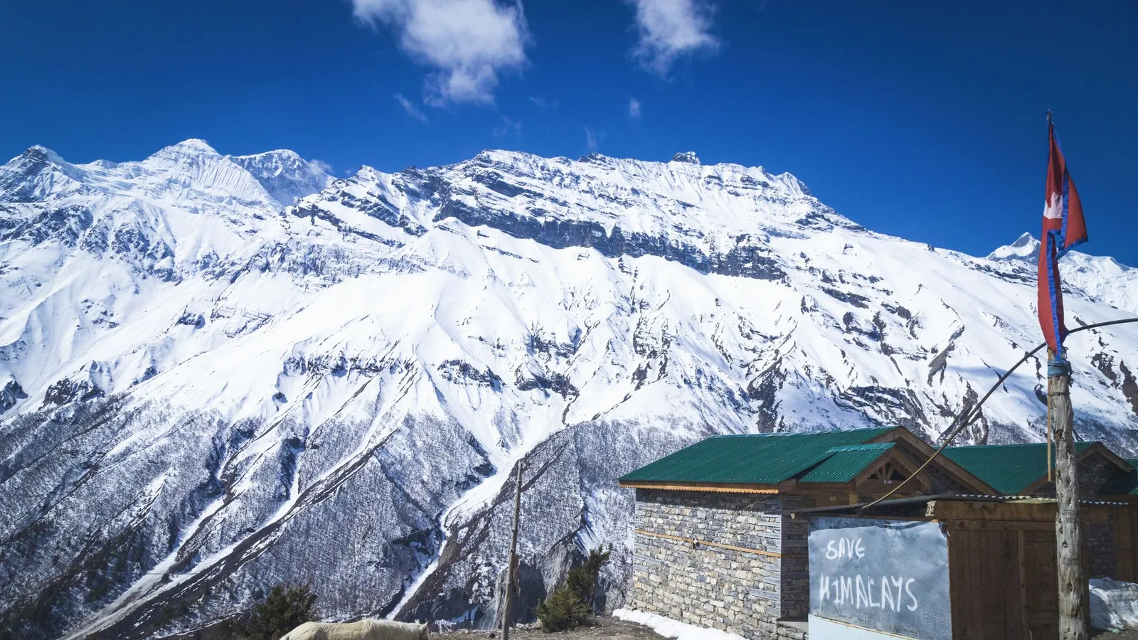
Safety & Advisories
Is the Nar Phu Valley Trek Affected by the 2026 Nepal Floods?
No — Nar Phu is a restricted Annapurna-region valley in Manang, on the Marsyangdi, far from the flood-hit Bhote Koshi in Rasuwa, and it is running normally. Here is why the trail is unaffected, plus the one monsoon road caveat.
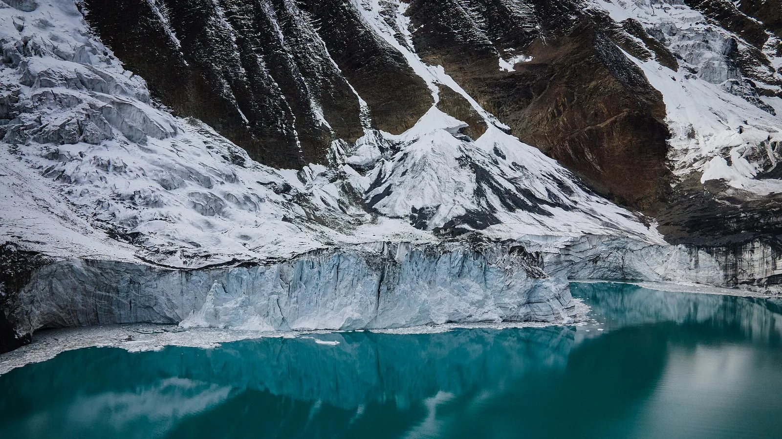
Safety & Advisories
Is the Tilicho Lake Trek Affected by the 2026 Nepal Floods?
No — Tilicho Lake is an Annapurna-region trek in Manang, on the Marsyangdi, well away from the flood-hit Bhote Koshi in Rasuwa, and it is running normally. Here is why the trail is unaffected, plus the one monsoon road caveat.
Latest from the desk
Trail & Weather
Nepal trekking news that actually changes your trip, updated for autumn 2026
The permit rules, fines, airfares, flight routes and road closures that changed for Nepal trekkers in 2026 — what to act on for an autumn booking, and what to ignore.
Safety & Advisories
Is Pokhara safe from the floods? Yes, but getting there from Kathmandu is the real problem
Pokhara and Kaski district were not hit by the 26 August 2026 flood, which came down a different river system about 150 km east. The road in from Kathmandu is the part that is broken.

Gear & Tech
Portable Wi-Fi and Travel Routers in 2026: Do You Actually Need One?
A pocket Wi-Fi box, a travel router, a phone hotspot, an eSIM or a local SIM — an honest buyer’s guide to what each does, when a device is worth it, and why none of them help where there’s no signal.