
The Langtang Lirung collapse wasn't a glacial lake flood, and that changes which mountains Nepal has to watch
A week of satellite, seismic and drone analysis has settled one thing — no lake burst above Rasuwa. The next one may not come from a lake either.
At a glance
- Published
- TopicClimate & Environment
- Verified againstThe Conversation, Nepali Times and npj Natural Hazards
- Treks coveredAnnapurna Base Camp Trek — 11 Days from Pokhara, Everest Base Camp Trek — 14 Days
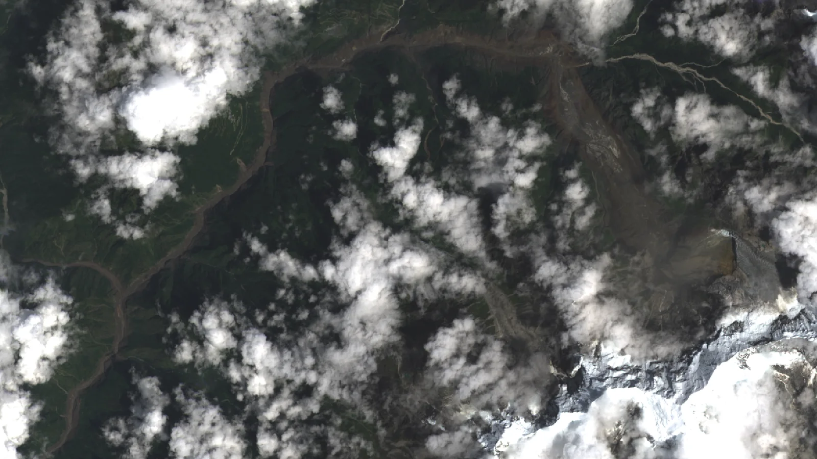
No glacial lake burst above Rasuwa on 26 August. That is the firmest conclusion from a week of satellite, seismic and drone analysis, and it matters more than it sounds. Nepal's flood-warning apparatus is built almost entirely around lakes. This disaster did not involve one. What failed was a slab of bedrock and hanging ice on the north face of Langtang Lirung — the collapse the USGS first logged as an earthquake — and that hazard sits on no published Nepali inventory at all.
What the week established
- Not a GLOF. No glacial lake drained. A rock-and-ice mass detached and fell, then dammed and released a river.
- Roughly 600 m wide, about 0.2 km² of ice and rock, detaching between 5,200 and 5,400 m and falling around 1,200 m.
- Volume estimates run 100–200 million m³ — at the top of that range, among the largest events of its type on record.
- Two agencies, two magnitudes: Ms 5.2 (USGS) and Mw 5.7 (GFZ Helmholtz Centre) for the same 02:52 UTC signal.
- A second failure, Ms 4.2, was recorded about three hours later. The slope was not finished.
- The trigger has not been formally attributed. Permafrost thaw is the leading hypothesis, not a finding.
What the week of analysis pinned down
The reconstruction came fast, through an ad hoc international group of 50-plus scientists who convene after mountain disasters to compare satellite scenes and field data — a network described by Umesh Haritashya of the University of Dayton. Planet Labs imagery gave them the scar, and a drone on the Chinese side appears to have caught the failure almost as it happened: a white mass sliding down the north face, then a brown dust cloud rising out of the Lhende Khola.
The numbers are now reasonably stable. Debris moved at around 50 m/s, about 180 km/h. Seven kilometres from the origin the flow ran 800 m up the valley side, in places standing 80 m above the riverbed, and left more than 1.5 m of silt through the disaster zone. ICIMOD's gauges recorded the Trishuli rising about nine metres in thirty minutes. Then the part that did the killing: the debris briefly dammed the valley, water backed up, and the dam failed. Two barrier lakes formed afterwards; the lower one was largely empty by 30 August. NDRRMA put the toll at 903 dead, 4,247 missing and 10,451 rescued on 31 August.
The trigger is still contested, and the scientists say so
Nobody has formally attributed the collapse. Climate scientist Zeke Hausfather put it plainly: "any formal attribution of this specific collapse to climate change is premature, and single events like this are genuinely hard to attribute even after careful study." Kristen Cook, in the same analysis, agrees it is "difficult to conclusively link a single event directly to climate change."
The setting is not contested. Dan Shugar of the University of Calgary says he is "100 percent" certain warming will make such events more likely "by some combination of glacier melt, permafrost thaw, and changes to precipitation and temperature patterns." Glacierised terrain above 4,000 m is warming at roughly 0.31 °C per decade against a global mean of 0.06–0.07, and Silwal and colleagues found this year that Langtang's glaciers retreated about 1.5 times faster over 2000–2023 than over 1964–2000, leaving ice stranded high on steep ground.
The mechanism people keep returning to is permafrost as cement: ice fills the joints in high bedrock and holds it together, and warming takes the cement away. Satellite scenes also show a lot of snow vanished in the days before 26 August, feeding meltwater into those fractures. Both are plausible. Neither is proven for this slope.
The same signature, five times in five years
| Event | Date | What failed | Dead | Missing |
|---|---|---|---|---|
| Chamoli, Uttarakhand | 7 Feb 2021 | Rock and ice avalanche, Ronti Peak (~27 Mm³) | 204 | — |
| Melamchi, Nepal | 16 Jun 2021 | Landslide-dam break and erosional cascade | 5 | 20 |
| South Lhonak, Sikkim | 3–4 Oct 2023 | Permafrost landslide into lake, then GLOF (~50 Mm³) | 55 | 74 |
| Thame, Khumbu | 16 Aug 2024 | Twin glacial lakes failing in sequence | 0 | 0 |
| Langtang Lirung / Bhote Koshi | 26 Aug 2026 | Rock and hanging-ice failure (100–200 Mm³) | 903 | 4,247 |
The lesson there is not "glacial lakes are dangerous". It is that five different objects failed — a rock face, a landslide dam, a moraine-dammed lake, a pair of tiny unlisted ponds, and now a hanging glacier — and only one was a lake anybody had flagged. The Thame post-mortem, published in Natural Hazards and Earth System Sciences on 27 August by Nitesh Khadka and Vishnu Prasad Pandey, is blunt about why: earlier assessments had "overlooked" both Ngole lakes because they fell below the minimum size threshold used for screening. Too small to count, and they took the village anyway.
Which valleys carry the same signature
The honest answer is that Nepal does not know, because nobody has counted. India has started. A basin-scale inventory in npj Natural Hazards this year mapped 219 hanging glaciers in the Alaknanda basin of the Garhwal Himalaya alone — 71.7 ± 3.5 km², of which 0.74 ± 0.14 km³ is hanging ice mass, close to a third of the basin's total ice volume, on slopes averaging 33°. At least 858 hanging glaciers have now been identified across the Indian Himalaya.
Uttarakhand's disaster management minister, Madan Kaushik, said after the Nepal disaster that "we have asked our teams to be vigilant and monitor if a similar situation is emerging anywhere in the state." Nepal has a watchlist for lakes — 21 classed as potentially dangerous — and, so far as published work shows, nothing for steep ice sitting on rock. Langtang Lirung was not on a watchlist because there is no watchlist for what it was.
The warning that existed and was never delivered
A security camera at Gyirong Port is stamped 10:59:53 China time — 08:44 NPT — roughly seven minutes after the seismic signal, about 14 km downstream. Seven minutes is not nothing. It is the difference between a school bell and a body count.
The signal existed. Seismometers registered the collapse the instant it happened — precisely why it was mistaken for an earthquake. What did not exist was any wiring from that signal to a siren in a village. Nepal's systems lean on river-level gauges, well suited to a monsoon rise over hours and useless against water moving at 50 m/s, and the flood destroyed gauges as it passed. Haritashya's proposal is the obvious one: seismic sensors that catch a large mass movement the instant it detaches, plus monitoring of what nobody monitors — hanging glaciers, steep ice-and-rock slopes, permafrost, and the short-lived debris dams that kill on release. We wrote about the alarm that isn't there earlier in this crisis. A week of science has added that it was pointed at the wrong object.
What this means for trekkers
What this means for you
Do not let this become a general fear of Himalayan trekking. Everest, Annapurna, Manaslu and the Khumbu are unaffected and running normally; the science here concerns one slope type, not walking in Nepal. What it should change is a habit: on any trek, know whether your route follows a narrow valley floor beneath high ice, and know which side is your high ground. These events arrive with minutes, not hours. The only warning that has ever reliably worked in the Himalaya is a person who moved uphill without waiting to be told.
Was the Langtang Lirung collapse a glacial lake outburst flood?
No. Analysts are consistent: no glacial lake drained. Rock and hanging ice failed off the north face, briefly dammed the river, and the dam released. It is a different hazard class from a GLOF, which is why it appeared on none of the lake inventories.
Has the trigger been formally attributed to climate change?
No, and researchers are explicit that attribution of this individual collapse is premature. Permafrost thaw weakening the ice that cements fractured bedrock, plus meltwater from an unusual pre-event snow loss, is the leading hypothesis. The broader context of accelerating retreat and rapid warming is not in dispute.
Why did the USGS and GFZ publish different magnitudes?
Because standard magnitude scales are built for earthquakes, and this was a mountain falling. USGS logged Ms 5.2, GFZ Mw 5.7, for the same signal. The disagreement is a symptom of the detection problem, not a mistake by either agency.
Which other valleys are exposed?
Unknown for Nepal, because no basin-scale hanging-glacier inventory has been published for it. Any narrow Himalayan valley with steep ice perched on rock above it shares the geometry — a large set nobody has yet narrowed.
For how fast the ice itself is changing, see Nepal's retreating glaciers; for the valley's current state and the autumn season, our running update has the latest.
Sources: USGS and GFZ Helmholtz Centre seismic catalogues; ICIMOD river-gauge reporting; NDRRMA situation report, 31 August 2026; Umesh Haritashya (University of Dayton) writing in The Conversation; Nepali Times field and satellite reporting; Silwal et al. (2026) on Langtang glacier recession; Khadka and Pandey, Natural Hazards and Earth System Sciences 26, 4131–4152 (2026); basin-scale hanging-glacier inventory, npj Natural Hazards 3, 44 (2026).
Still running this season
Annapurna Base Camp Trek — 11 Days from Pokhara is running normally
NMA-certified local guides, transparent pricing, 5,000+ treks since 1998. Message us your dates and we'll sort the permits, lodges and logistics — reply within 24 hours, no obligation.

Popular Nepal treks
All treks →


Related coverage
Breaking Safety & Advisories
Nepal Floods 2026: Live Updates, Death Toll and Trek Status (Rasuwa / Bhote Koshi + Nationwide)
Live tracker of Nepal’s August 2026 floods — the provisional, rising death toll across eight districts, the disputed cause of the Bhote Koshi glacial flood in Rasuwa, and what it means for trekkers right now.

Climate & Environment
Nepal Has Mapped 2,070 Glacial Lakes. The One That Burst Was Not On the List.
A new ICIMOD and UNDP inventory counts 3,624 glacial lakes and flags 47 as dangerous — 42 of them in the Koshi basin. The lake that killed at least 165 people in August was not among them, because it did not exist the day before.
Climate & Environment
Why Nepal Keeps Getting Blindsided by Glacial Floods — and the Alarm That Isn't There
Nepal's flood alarms watch its own known lakes — but the Bhote Koshi's disasters keep starting across the border in Tibet, beyond every sensor, arriving with minutes of warning at best.
Climate & Environment
Glacial lake outburst floods are Nepal's fastest-growing mountain hazard, here's why
As Himalayan glaciers retreat they leave meltwater lakes dammed by loose moraine — and when a dam fails, the flood tears down the valley. Here is what a GLOF is, why they are increasing, and what Nepal is doing about it.
Latest from the desk
Safety & Advisories
Nepal's flood camps are running out of water and medicine, and the doctors are warning about an epidemic
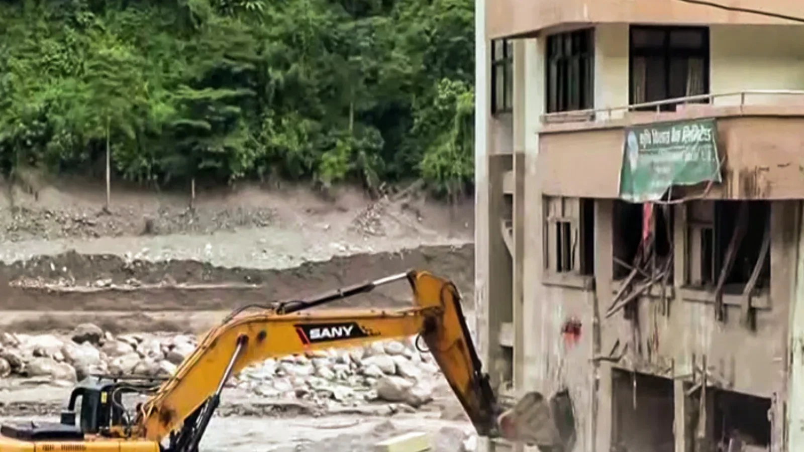
Four health facilities in Rasuwa are destroyed, Trishuli Hospital has lost its bridges and its medicines, and 1,000 people are in camps with no clean water.
Safety & Advisories
592 foreign nationals are still missing in the Nepal flood, here is who your family should actually call
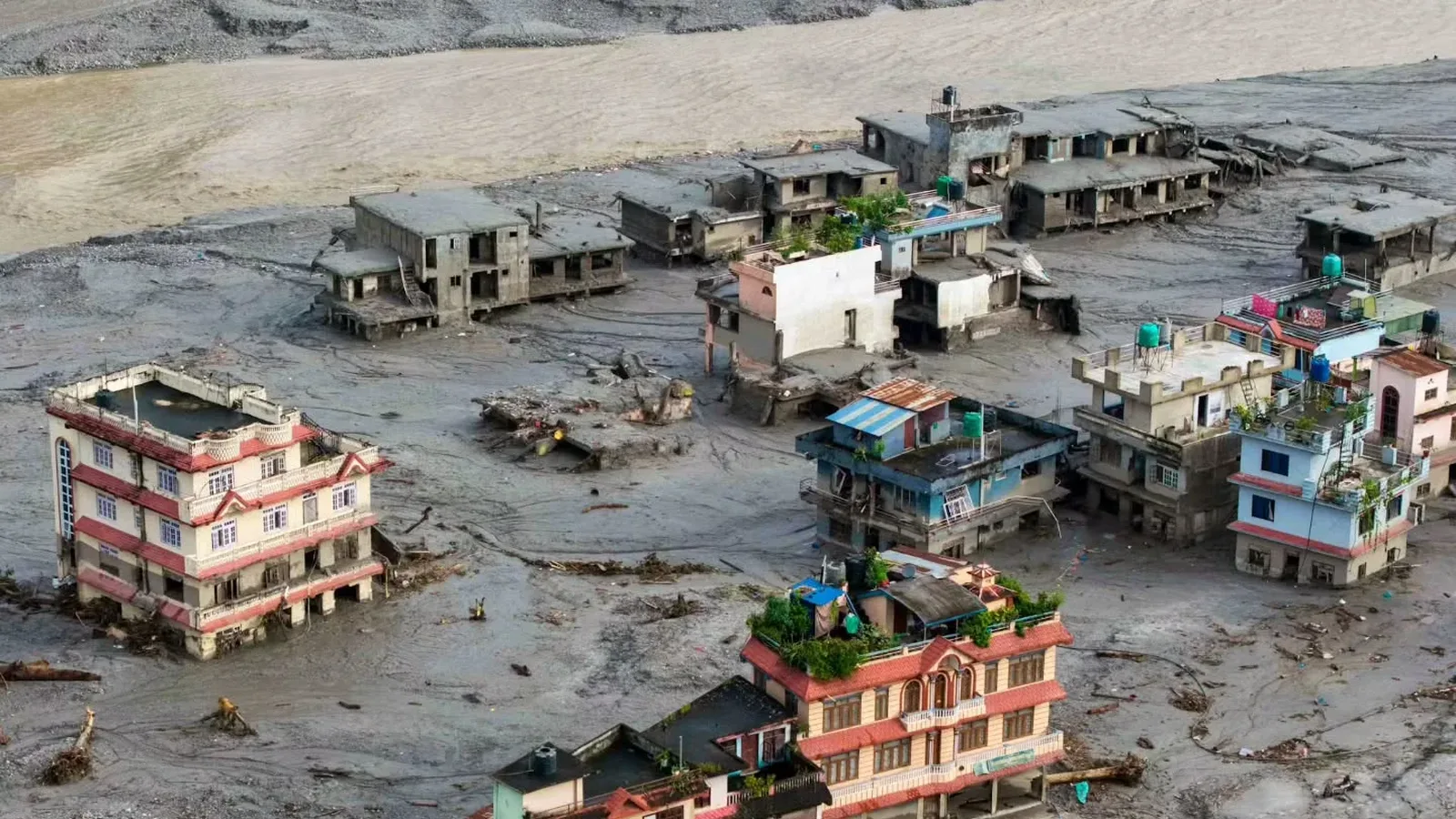
Nepal's disaster authority counts 592 foreign nationals among the missing after the 26 August flood. Here is the official route for families abroad.
Safety & Advisories
Nepal's missing hydropower tunnel workers and the Rasuwagadhi search that found nobody inside
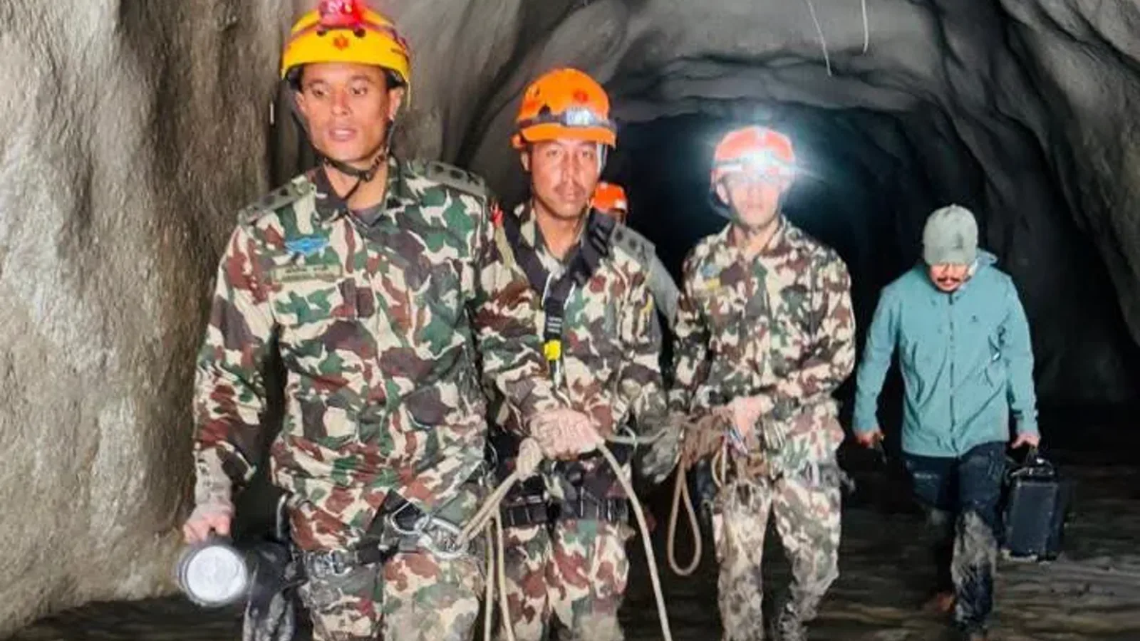
Rescuers reached the end of the Rasuwagadhi tunnel and found no one there, and it did not bring 93 workers home because most of them were never in the tunnel.