
内容速览
An honest, guide’s-eye ranking of Nepal’s higher-risk treks — the high passes, remote routes and flood/GLOF zones — with the verified incidents behind each reputation and exactly how a good operator manages the risk. Most Nepal trekking is safe; here is where it is not.
Let me start with the truth that matters most, because the rest of this article is useless without it: the great majority of trekking in Nepal is safe. Tens of thousands of people walk these trails every season and go home tired, happy and intact. Nepal's trails are not a lottery of survival, whatever a dramatic headline suggests. But some routes carry more objective risk than others, and pretending otherwise would be dishonest — and dishonesty, on a mountain, gets people hurt.
So this is a guide's honest ranking of Nepal's higher-risk treks, with the real incidents behind each reputation and, more importantly, exactly how the risk is managed. The goal is not to frighten you off. It is to show you that the danger on these routes is understood, named, and worked around every single season by people who do it for a living. Risk you can name is risk you can manage.
Nepal's higher-risk treks, ranked
This ranks routes by objective hazard — the things the mountain does regardless of your fitness — not by how hard they feel. A short steep trek can be exhausting and still be low-risk; a gentle-looking high pass can be the opposite.
| Trek / route | High point | Main objective risk | Risk level |
|---|---|---|---|
| Annapurna Circuit — Thorong La | 5,416 m | Sudden high-pass weather, altitude | High |
| Everest Three Passes | 5,535 m (Kongma La) | Altitude, remoteness, three big passes | High |
| Upper Dolpo & far-west routes | ~5,300 m | Extreme remoteness, no fast rescue | High |
| Manaslu Circuit — Larke La | 5,106 m | Single high pass, weather, restricted area | High |
| Kanchenjunga & Makalu base camps | ~5,100–5,300 m | Remoteness, long committing days | Moderate–High |
| Everest Base Camp | 5,545 m (Kala Patthar) | Altitude (not technical) | Moderate |
| Annapurna Base Camp | 4,130 m | Seasonal avalanche paths, altitude | Moderate |
| Ghorepani / Poon Hill, Ghandruk | ~3,210 m | Low — standard trail hazards only | Low |
Look at the shape of that table. The bottom rows — the low and moderate treks — are where most travellers actually go, and they are genuinely low-risk. The dangerous reputation of Nepal trekking is built almost entirely on the top rows, and even those are done safely by the great majority of people who attempt them with proper preparation. Now let us take the real risks one by one.
1. The high passes: where weather turns lethal
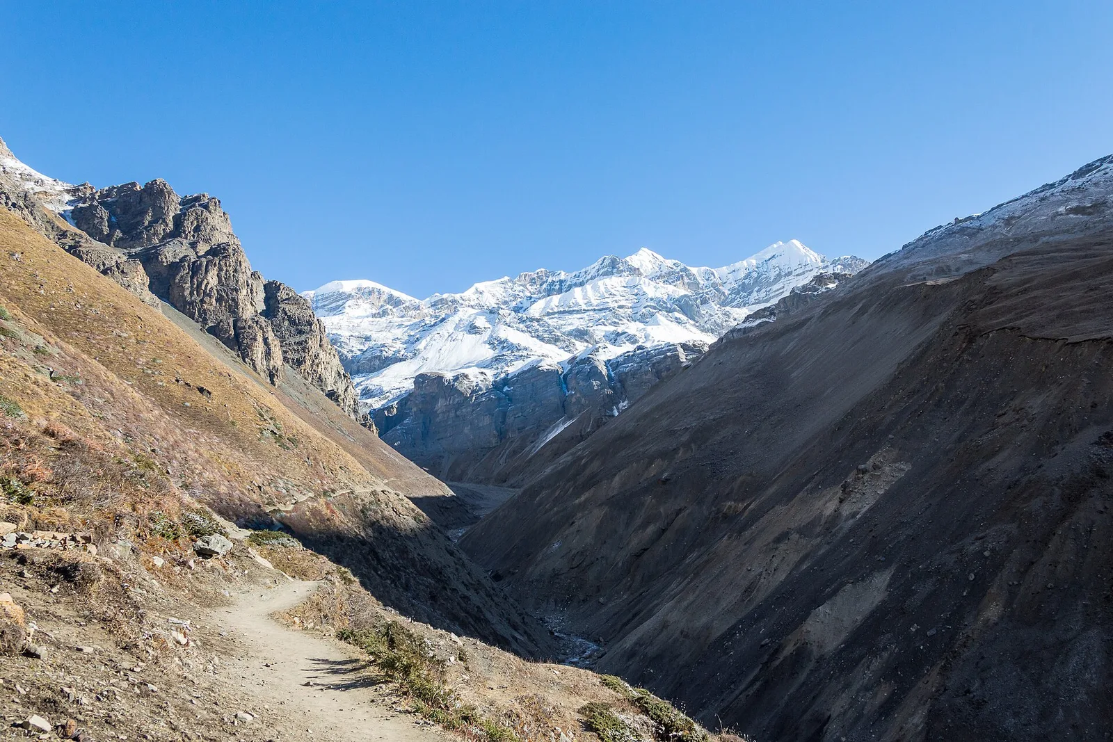
The single most dangerous feature on any Nepal trek is a high pass in bad weather. A pass concentrates every hazard at once: maximum altitude, full exposure to wind, nowhere to shelter, and a long committing descent on the far side. Get the timing wrong and there is no easy way out.
The worst trekking disaster in Nepal's history proves the point. On 14 October 2014, during peak autumn season, the remnants of Cyclone Hudhud dumped metres of snow on the Annapurna Circuit's Thorong La pass (5,416 m) in a matter of hours. Hundreds of trekkers were caught. At least 43 people died — foreign trekkers and Nepali porters and guides alike — from hypothermia, exposure and avalanche. It remains the deadliest weather event on the Nepal trails.
What made it so deadly was not the pass itself, which thousands cross safely every year. It was an unforecast extreme storm meeting a crowd of people committed to crossing on a fixed schedule, many of them under-equipped and some without guides who could read the sky and call a halt. The Everest region's Three Passes route — Kongma La at 5,535 m, Cho La at around 5,420 m, Renjo La at around 5,360 m — carries the same category of risk three times over, plus serious remoteness between them. These are magnificent routes. They are also the routes where a weather call is the difference that matters most.
How we manage it: we watch the forecast obsessively in the days before a pass, we build the schedule with spare days so we are never forced to cross on a bad morning, we start high-pass days before dawn to be over and down before the afternoon weather builds, and we carry the authority to say no. A pass will still be there next season. Turning around is not failure; it is the entire skill.
2. Everest Base Camp and the altitude problem
Everest Base Camp is not a technical trek — there is no climbing, no ropes, no exposure to falling ice. Its risk is one thing and one thing only: altitude. The trail climbs to 5,364 metres at Base Camp and 5,545 metres at the Kala Patthar viewpoint, high enough that acute mountain sickness is a real and occasionally serious concern, and its dangerous forms — fluid on the lungs or the brain — can develop fast if warnings are ignored.
The reassuring part is that altitude illness is among the most manageable of all mountain hazards, because it follows rules. Ascend gradually, sleep no more than a few hundred metres higher each night above 3,000 metres, take genuine acclimatisation days, hydrate, and descend at the first sign that a body is not adjusting, and the risk falls dramatically. Almost every serious altitude incident I have seen came from breaking those rules — usually by going too high too fast to save a day or two.
How we manage it: our itineraries are profiled specifically for acclimatisation, with rest days at Namche and Dingboche built in rather than bolted on, guides trained to spot early symptoms in every member, and a firm policy of descending anyone who is not coping. We would rather you reach Base Camp a day later than planned than a day sooner and unwell. If you want the honest detail, we wrote a whole piece on it: How Hard Is Everest Base Camp Really?
3. The remote routes: when help is days away
Some of Nepal's most beautiful trekking is also its most committing, not because the walking is technical but because you are a very long way from help. Upper Dolpo and the far-west routes, the Kanchenjunga base camps in the far east, the Makalu approach — these are places where a helicopter cannot always reach you quickly, where weather can ground flights for days, and where a twisted ankle or a stomach bug becomes a genuine logistical problem rather than a minor inconvenience.
Remoteness is a multiplier. It does not create new hazards so much as it removes your safety net. An altitude problem that would be resolved in an afternoon on the EBC trail, with its helipads and clinics, is a far more serious matter three days' walk from the nearest airstrip.
How we manage it: remote treks demand a different standard — comprehensive insurance that genuinely covers helicopter evacuation, satellite communication carried by the guide, conservative pacing with real margin, a properly equipped team rather than a lone porter, and honest client screening so that people take on this level of commitment with their eyes open. On these routes, self-sufficiency is not optional and a cut-price operator is a false economy.
4. Floods and glacial lakes: the risk that is growing
The newest entry on any honest risk list is water, and it is the one changing fastest. A warming Himalaya is producing more glacial lake outburst floods — a GLOF, when a natural dam of ice or moraine holding back a glacial lake gives way and sends a wall of water and debris down the valley — and more extreme monsoon and post-monsoon rainfall.
This is not theoretical. On 16 August 2024 a cascading glacial lake outburst flood tore through Thame, a Sherpa village on the Everest region's trekking network at around 3,800 metres, destroying some 25 homes and guesthouses, a school and a health post and displacing 135 people. Remarkably, no one was killed — but the water erased buildings on a trail thousands walk each year. Researchers note the Everest region alone has seen five significant GLOFs in under 50 years. And in late August 2026, flash flooding hit valleys in the Bhote Koshi and Rasuwa areas, disrupting trekking access and infrastructure on the northern routes. We keep a running, region-by-region status of current conditions here: Nepal Trekking Conditions Right Now.
How we manage it: flood and GLOF risk is a monsoon-season and route-selection question. We avoid the highest-water months on the most exposed valleys, we monitor official hazard advisories and current conditions before and during every trip, we adjust routing around damaged sections rather than pushing through them, and we are candid with travellers when a region needs a season to recover. This is exactly why we publish live condition reports instead of pretending every trail is always open.
5. Manaslu Circuit: a serious pass in a restricted land
The Manaslu Circuit deserves its own mention because it combines several risks in one loop. It crosses the Larke La pass at 5,106 metres, it is a restricted area requiring permits and, by law, a licensed guide and a minimum group, and it runs through comparatively remote country with fewer facilities than the Annapurna or Everest trails. Manaslu the mountain is one of the world's deadliest 8,000-metre peaks for climbers, but that is a separate matter from the trek, which stays low on the flanks and crosses a single high pass.
The trek's risk profile is essentially the high-pass and remoteness story combined: get the Larke La weather window right and travel with a properly equipped team, and it is a superb and reasonable undertaking. The permit rules that some travellers grumble about — mandatory licensed guide, minimum party size — exist precisely because this is not a route to attempt alone and under-supported.
The safe majority — and why they still deserve respect
Set against all of the above is the reality of where most people actually trek: Ghorepani and Poon Hill, Ghandruk, the lower Annapurna foothills, the Everest view treks that stop well below Base Camp. These top out around 3,000–3,200 metres, stay in country thick with teahouses and quick to evacuate, and carry no more objective danger than a hill walk with a lot of stairs. They are genuinely low-risk, and they are wonderful. If a headline has made you think all Nepal trekking is a brush with death, these routes are the honest correction.
Even here, respect matters — weather, hydration, sensible footwear and not walking alone off the main trails — but the gap in objective risk between a Poon Hill trek and a solo unguided high-pass crossing is enormous. Choosing the right trek for your experience is itself the most important safety decision you will make.
How the risk is actually managed — the short version
Strip away the specifics and the same handful of things keep trekkers safe on every route in this article: a schedule with acclimatisation and spare days built in, so no one is forced into a bad decision by the calendar; guides who read weather and altitude and carry the authority to turn a group around; real communications and genuinely comprehensive evacuation insurance; a properly equipped and fairly treated team rather than a lone underpaid porter; and honest matching of the trek to the traveller. None of that is glamorous. All of it is why the overwhelming majority of trips end with tired legs and a full camera roll rather than a rescue.
That last point — a well-supported team and a guide empowered to make the safe call — is the difference the 2014 Thorong La disaster made painfully clear, and it is the difference between the two ways to cross a high pass. If you want to walk the Annapurna Circuit and stand on Thorong La, our 13-day Annapurna Circuit Trek is built to do the hard part safely — profiled acclimatisation before the pass, spare days so the crossing waits for good weather, licensed guides who have read that sky for years, and full evacuation support behind you. Solo travellers start from USD 1,400, less per person in a small group. You get the high pass. You do not get it on a bad morning, alone, under-equipped.
Read this next
For the mountains themselves rather than the trails, see The 10 Deadliest Mountains in the World and, for why the summit zone kills climbers, Why Do People Die on Everest?. To understand the one hazard that touches nearly every high trek, our honest assessment of the EBC trek covers altitude in depth. And for the current, region-by-region state of the trails after the 2026 floods, keep an eye on Nepal Trekking Conditions Right Now.
Frequently asked questions
What is the most dangerous trek in Nepal?
By objective risk, the high-pass treks rank highest — the Annapurna Circuit's Thorong La (5,416 m) and the Everest Three Passes (up to Kongma La at 5,535 m) — because a high pass combines maximum altitude, full weather exposure and a long committing descent. The far-west and Upper Dolpo routes are also high-risk mainly because of extreme remoteness. Most of Nepal's trekking, however, is low or moderate risk.
How many people died in the 2014 Annapurna trekking disaster?
At least 43 people died on and around the Thorong La pass on 14 October 2014, when the remnants of Cyclone Hudhud dropped metres of snow in hours during peak season. The dead included foreign trekkers, porters and guides. It remains the deadliest weather event in the history of Nepal's trekking trails.
Is the Everest Base Camp trek dangerous?
The EBC trek is not technical — there is no climbing — and its main risk is altitude, which is highly manageable with gradual ascent, acclimatisation days and a guide watching for symptoms. Handled properly, it is a demanding but reasonable trek. Its risk is completely separate from climbing Everest, which involves the deadly Khumbu Icefall and Death Zone that trekkers never enter.
Are glacial lake floods a real risk for trekkers now?
They are a growing risk in a warming Himalaya. A glacial lake outburst flood destroyed much of Thame village in the Everest region on 16 August 2024, and flash floods hit the Bhote Koshi and Rasuwa areas in August 2026. The risk is largely seasonal and route-specific, managed by avoiding the highest-water months on exposed valleys and monitoring current conditions, which is why we publish live regional status reports.
Do I need a guide to trek safely in Nepal?
For low treks like Poon Hill a guide adds value but the risk is modest; for high-pass, remote and restricted-area treks a licensed guide is genuinely a safety essential and, in restricted areas like Manaslu and Upper Dolpo, a legal requirement. A guide who can read weather and altitude and has the authority to turn a group around is the single biggest factor separating a safe high trek from a dangerous one.
Which Nepal treks are safest for beginners?
The Ghorepani and Poon Hill trek, Ghandruk village trek and the lower Annapurna foothill routes are the safest options, topping out around 3,000–3,200 metres with plentiful teahouses and quick evacuation. They carry little more objective risk than a strenuous hill walk and are ideal first Himalayan treks.
撰文
Dawa Sherpa我们是常驻博卡拉、经NMA认证的徒步向导。自1998年以来,已在安纳普尔纳与珠峰地区带领超过5,000次徒步——这里的每一句话都源自山路。 More from this author →
分享这篇文章
准备好出发了吗?
从读到它,到站上它
我们常驻博卡拉的向导自1998年以来一直从事此行。告诉我们您的日期与体能水平——我们将为您打造完美行程。免费,无任何义务。
Why trek with our licensed agencyFree Trekker's Insider Guide
Permits, packing lists, cost breakdowns — no fluff.
We send one useful email. You can unsubscribe anytime.