
Lukla Is the World's Most Dangerous Airport — and There's No Way to Abort the Landing
A 527-metre runway that ends in a cliff, an 11.7% uphill slope and no second attempt. Meet the airstrip every Everest trekker has to land on first.
At a glance
- Published · updated
- TopicFlights & Access
- Verified againstWikipedia — Tenzing-Hillary Airport
- Treks coveredEverest Base Camp Helicopter Tour — 1 Day, Everest Base Camp Trek — 12 Days, Everest Base Camp Trek — 14 Days
Key facts
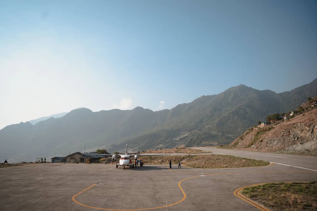
- Runway length: just 527 metres (1,729 ft) — a fraction of a normal commercial runway
- Elevation: 2,845m (9,334 ft), among the highest airports any trekker will ever land at
- Gradient: an 11.7% uphill slope that helps stop landing planes and helps launch departing ones
- Renamed Tenzing-Hillary Airport in 2008, after the first two men confirmed to summit Everest
There is one runway on Earth where the pilot cannot change their mind halfway down. At Tenzing-Hillary Airport in Lukla, the gateway to Everest, the strip is 527 metres long, tilted uphill at an 11.7% gradient, boxed in by mountainside on three sides, and ends at a stone wall with a cliff behind it. There is no go-around. A pilot commits to the landing the moment the wheels are down, because there is nowhere else to put the plane.
Every trekking season, small STOL aircraft thread a narrow valley to reach this single asphalt strip carved into a hillside at 2,845 metres, carrying the great majority of foreign trekkers who attempt Everest Base Camp each year, along with their guides, porters and supplies. In its busiest recorded year, 2017, the airport handled around 147,000 passengers — remarkable traffic for a runway shorter than five football pitches laid end to end.
How Hillary built it
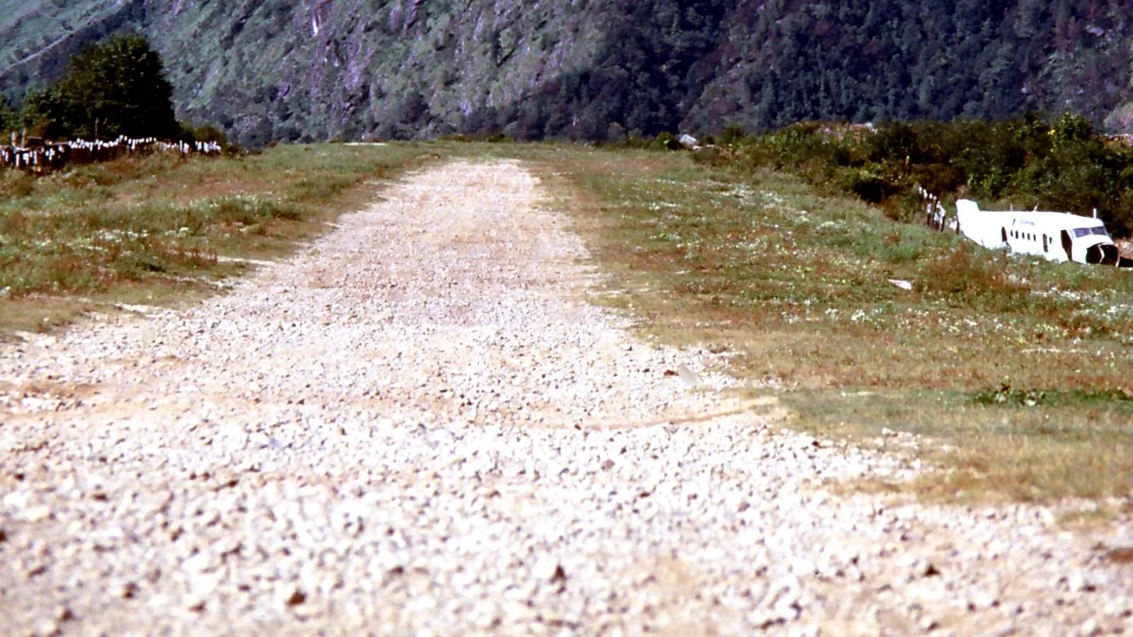
The airport wasn't built by an aviation authority. It was built by Sir Edmund Hillary.
Local farmers refused to sell their flat land, so Hillary bought a patch of sloping land from Sherpa villagers for about $2,650. Local lore says he had them flatten it by throwing a party and getting the crowd to stamp the earth down in a traditional dance.
For 37 years the strip was packed dirt and gravel. It was only surfaced with asphalt in 2001, as trekking and climbing traffic to Everest kept growing.
On 10 February 2008, Nepal's government renamed it to honour Tenzing Norgay and Edmund Hillary, the first two people confirmed to stand on Everest's summit, in 1953.
Why there's no second attempt
Most airports let a pilot abort a bad approach and circle back. Lukla's geography removes that option entirely: high terrain sits immediately beyond the runway's upper end, and a steep drop falls away at the lower end, where the terminal building and a cliff wait. A missed approach has nowhere safe to go, so pilots are trained never to attempt one — they land, or they divert long before they're anywhere near the strip.
Because of that, only pilots who have logged at least 100 short-takeoff-and-landing missions and more than a year of that flying in Nepal, and have then made ten landings at Lukla alongside a certified instructor, are permitted to fly the route. The strip is 527 metres long and just 30 metres wide, flown entirely by eye, and cloud shuts it roughly half the time in the monsoon. The uphill gradient that makes Lukla famous is also, oddly, part of what makes it survivable: the same 11.7% slope that helps a landing plane brake in a short distance also gives a departing one a downhill run-up, using gravity to reach flying speed before the runway runs out.
The accident record, in proportion
Lukla's reputation is real, and so is its record: a handful of serious accidents across decades of daily flights. A 2010 History Channel programme ranked it the most dangerous airport in the world, and the label has stuck. The worst accident came on 8 October 2008, when Yeti Airlines Flight 101 crashed on approach in fog, killing 18 people. On 27 May 2017 a Summit Air crash killed two crew members, and on 14 April 2019 a collision on the ground between a Summit Air aircraft and Manang Air helicopters killed three.
Set that against the traffic — close to 147,000 passengers in the busiest year alone — and the per-flight risk is low. What the record really teaches is the thing every pilot on the route already knows: the weather decides, not the schedule.
What this means for your trek
What this means for your trek
Lukla flights fly early for a reason: mountain wind picks up by mid-morning and the strip regularly closes by 10 or 11am, so almost every departure is scheduled for first light. During the two busiest trekking seasons — spring and autumn — Nepal's Civil Aviation Authority often shifts Lukla flights away from Kathmandu's main airport entirely, to Manthali airport in Ramechhap, several hours' drive from the city, simply to give planes a calmer, less congested morning window. Build at least one buffer day into any Everest itinerary regardless of which airport you fly from — fog and wind delays are routine, not rare, and a missed connecting flight home is the single most common thing that goes wrong on an EBC trip. If your schedule genuinely cannot absorb a delay, a helicopter transfer gives you a fixed, bookable time instead of a weather-dependent one.
None of this makes Lukla unsafe by design — modern Nepali carriers fly it daily throughout the trekking seasons with rigorously trained crews, and our own guides fly it dozens of times a year. It simply means the flight is part of the adventure, not a formality before it. We build every Everest Base Camp itinerary with a buffer day around the Lukla flights for exactly this reason, and for travellers on a fixed schedule we also run a fixed-time helicopter version that skips the runway roulette entirely. For more on how real the risks on Everest's trails actually are, see our look at what the death and rescue data actually says.
Source: Tenzing-Hillary Airport, Wikipedia (pilot requirements, accident record and the 2010 History Channel ranking)
Cover photo: Albert Backer via Wikimedia Commons (CC BY-SA 4.0). Section photos: aaerux studio via Pexels (Pexels licence). Section photos: aaerux studio via Pexels (Pexels licence); Cheer Miron Asso via Pexels (Pexels licence).
Still running this season
Everest Base Camp Helicopter Tour — 1 Day is running normally
NMA-certified local guides, transparent pricing, 5,000+ treks since 1998. Message us your dates and we'll sort the permits, lodges and logistics — reply within 24 hours, no obligation.
Popular Nepal treks
All treks →
Related coverage
Records & People
Eight Sherpas Build the Path Every Everest Climber Walks, and This Spring One Ice Tower Stopped Them for 19 Days
The Icefall Doctors fix the ladders and ropes through the Khumbu Icefall each spring, and in 2026 a 28-metre serac made it the latest route opening in years.

Flights & Access
Everest Base Camp Trek or Helicopter Tour? The Kala Patthar Reopening Changes the Math in 2026
A shared helicopter can land you on Kala Patthar again after a three-year ban, but it still can't buy you what nine days on the trail does.
World Destinations
The airports where a pilot needs a special licence just to land
US law names them, Bhutan lets in a handful of its own pilots, and Lukla has a 527 m runway on a 12% slope. Why these six close when the cloud comes in.
Permits & Rules
Nepal Now Stations Rangers at 6,400 Metres on Everest to Weigh Climbers' Rubbish, Poop Bags Included
Everest's first mountain rangers weighed 9.5 tonnes of waste this spring, and 1.76 tonnes of it was human waste carried down in bags.
Latest from the desk
Breaking Safety & Advisories
An Avalanche Buried Himlung Himal's Base Camp in Nepal, and Ten Climbers and Staff Are Missing
An avalanche hit Himlung Himal's base camp in Nepal's Manang district on 27 September, and rescuers are searching snow for ten missing climbers and staff.

Money & Insurance
You Could Be Owed Cash From a $167 Million Visa and Mastercard Settlement, Here's How to Check
Visa and Mastercard are paying $167.5 million after allegedly blocking cheaper ATM fees, and the claim deadline is 10 February 2027.
Wildlife & Nature
Chitwan or Bardia, here's which Nepal safari you should actually book
Nepal's 2026 tiger census found record numbers in Chitwan and a rare decline in Bardia, and it changes the honest answer to which safari to book.